Geoprocessing
and Geoanalysis
{
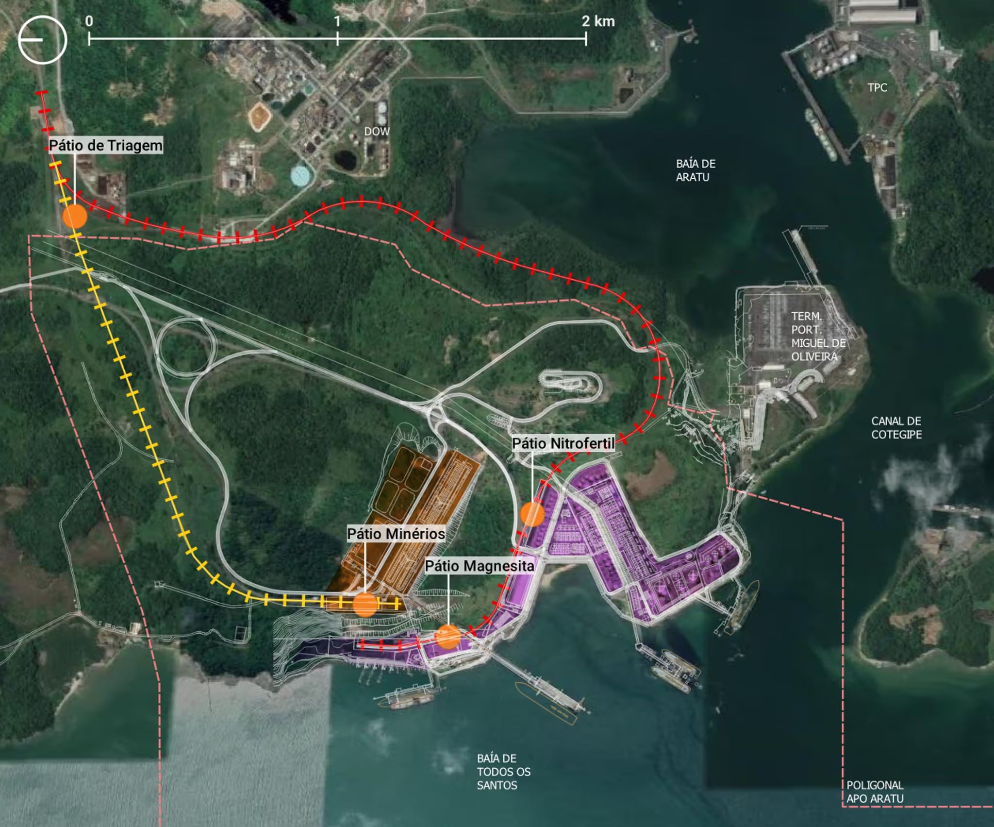
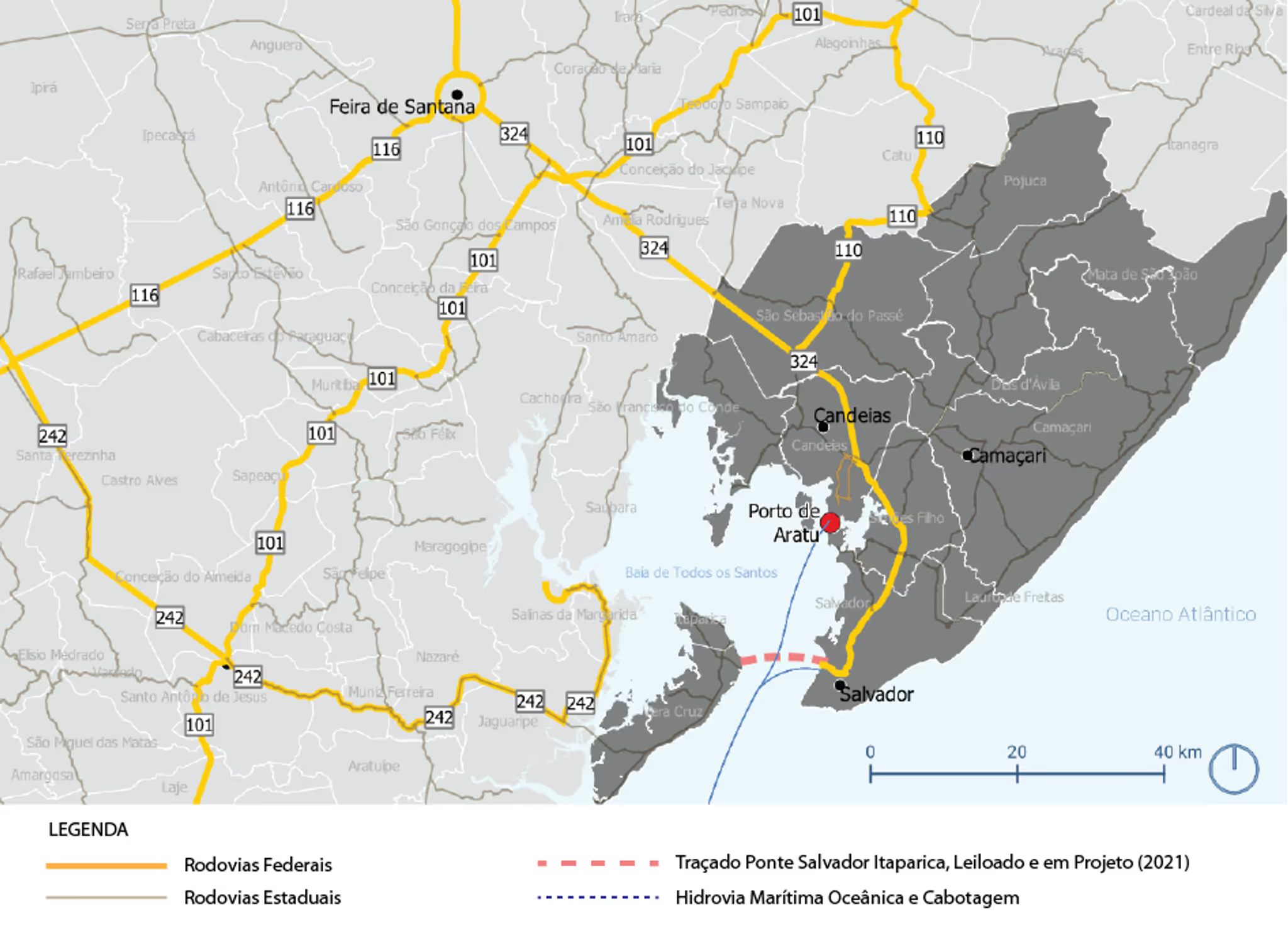
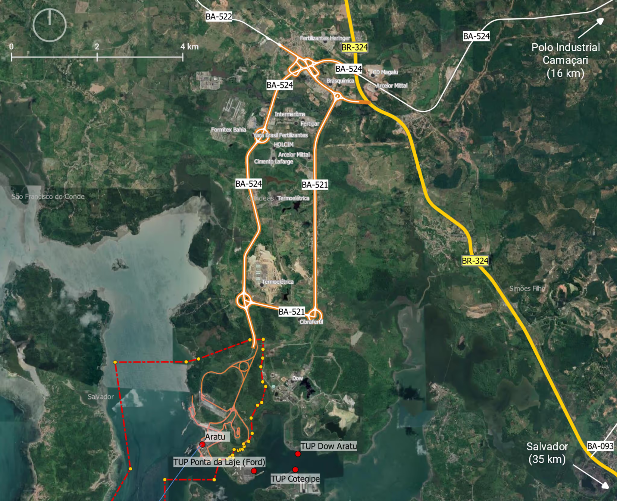
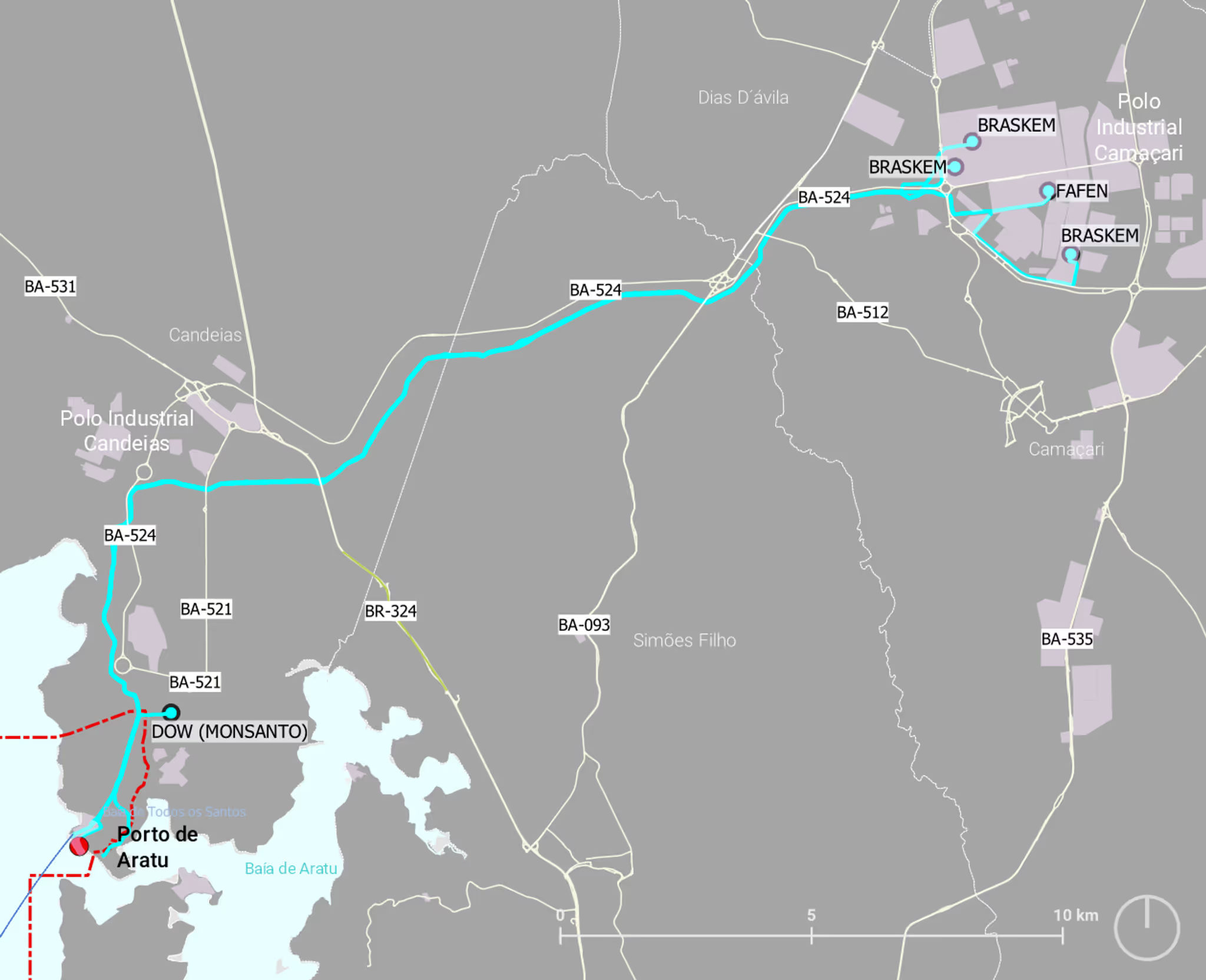
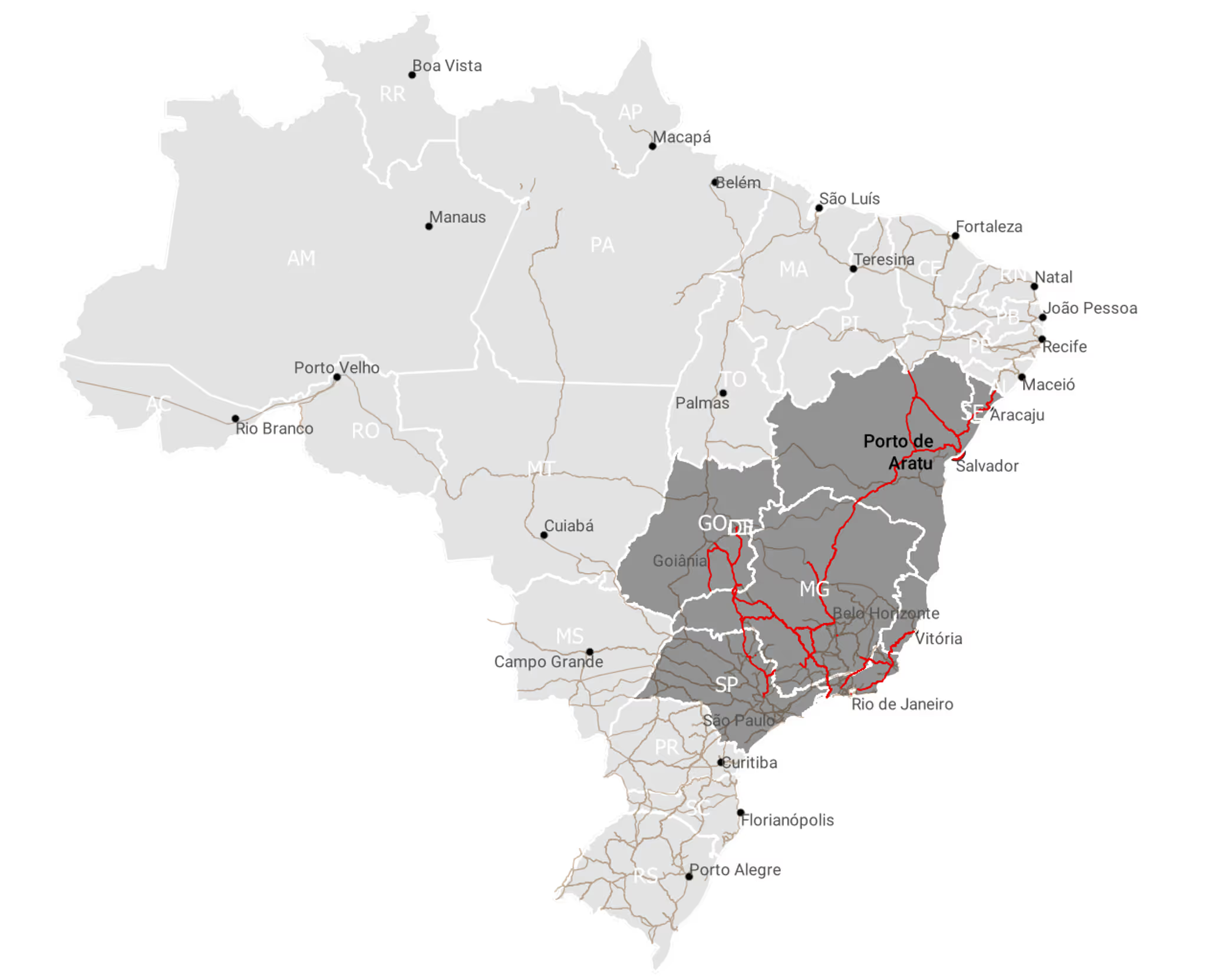
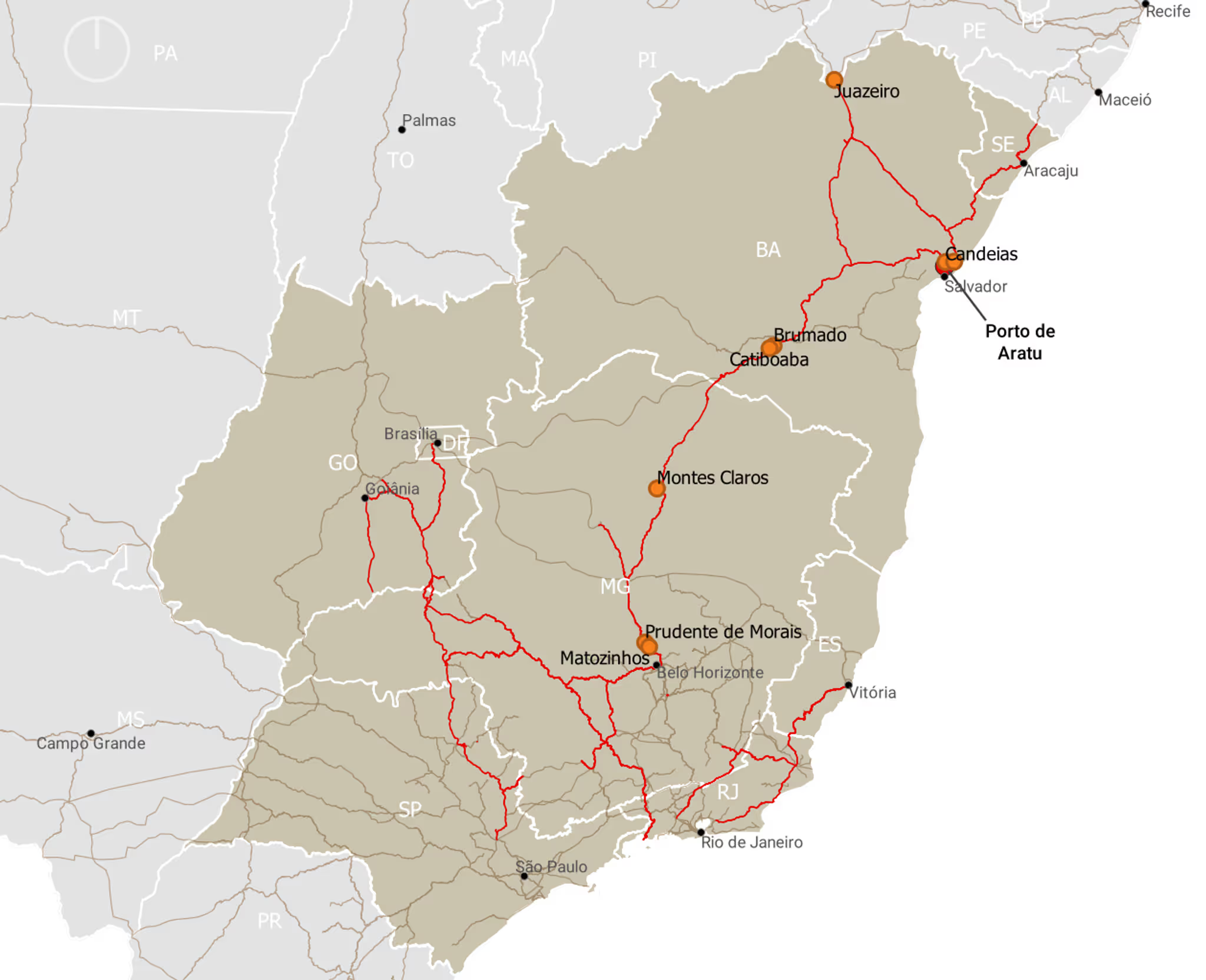
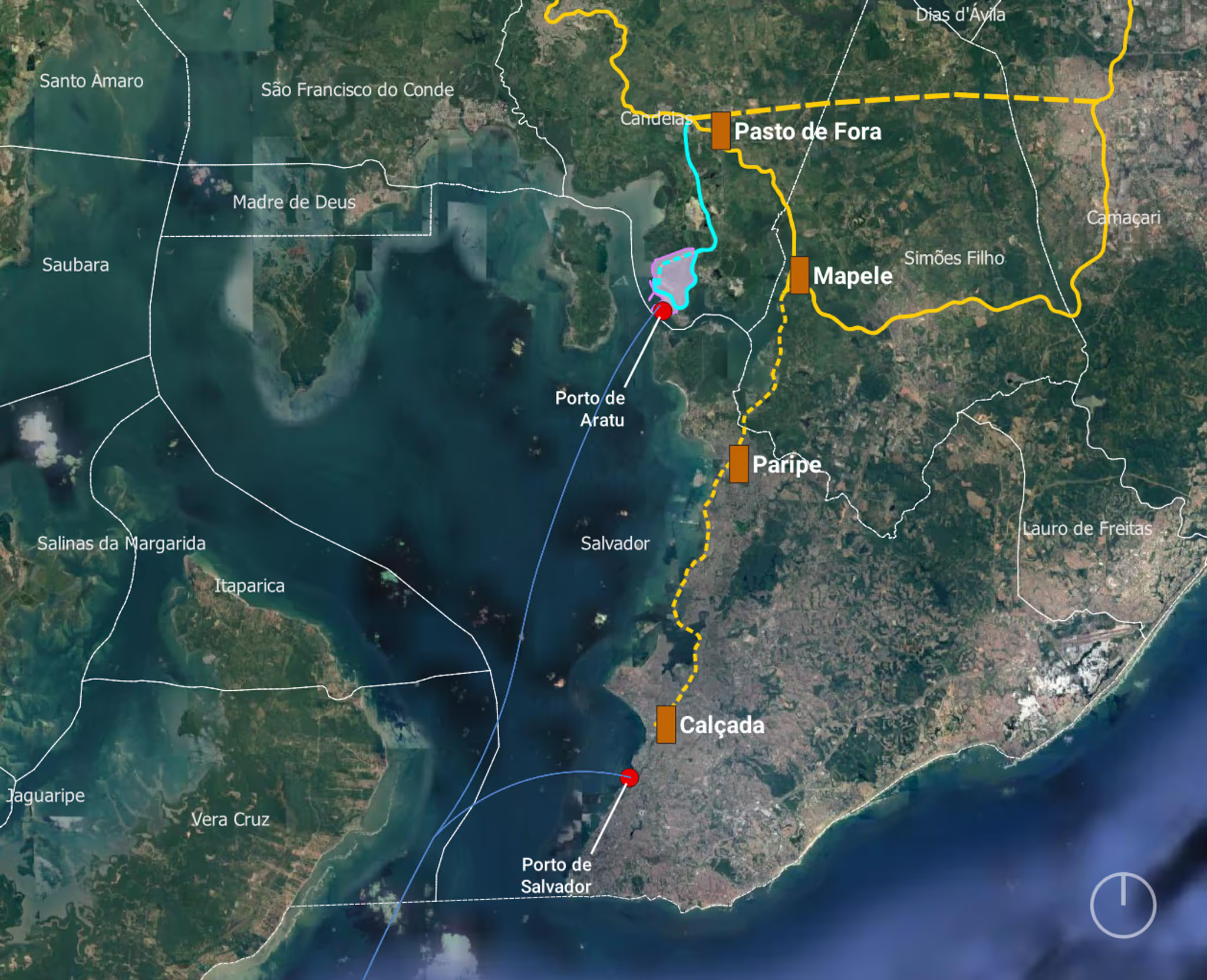
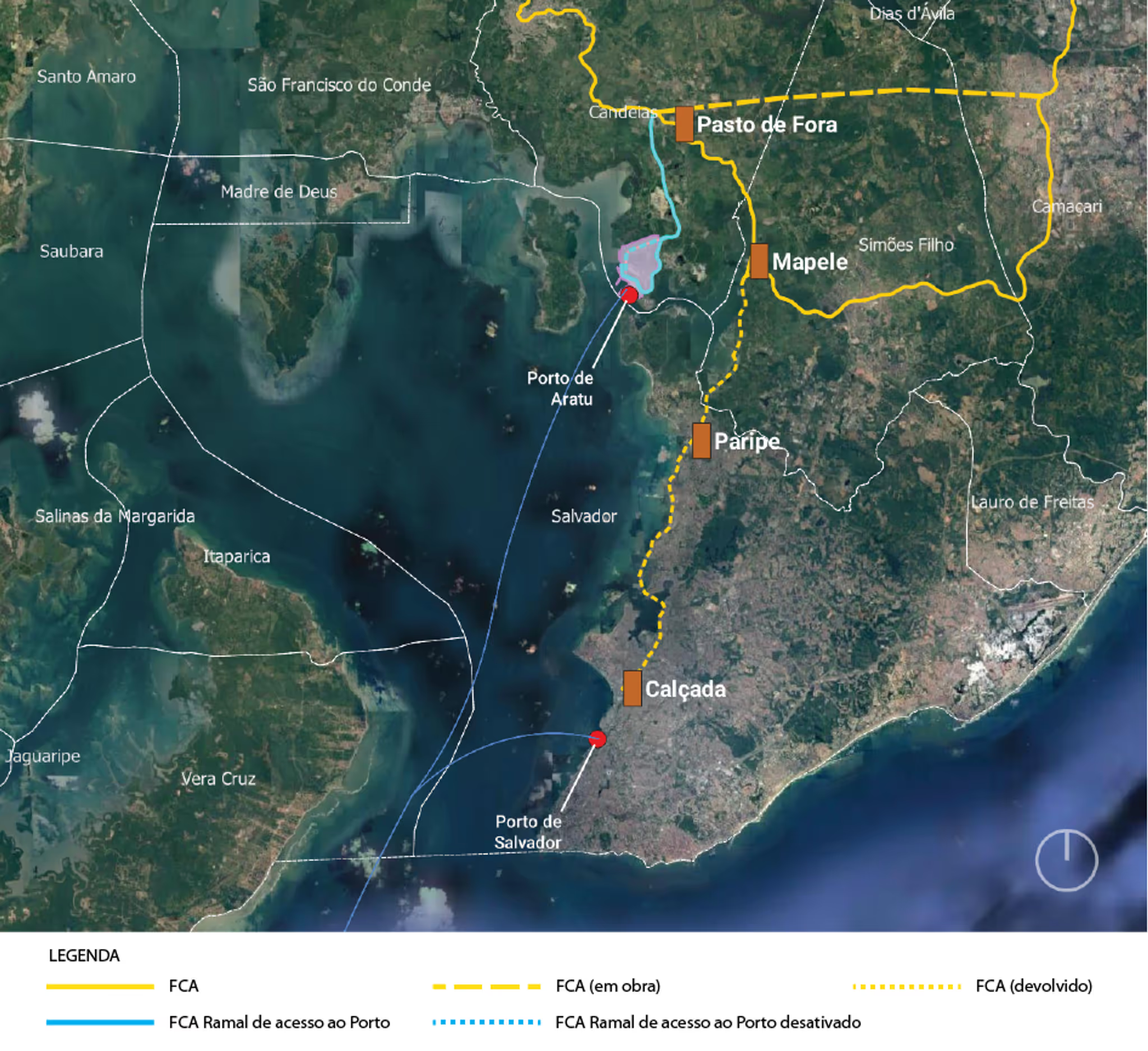
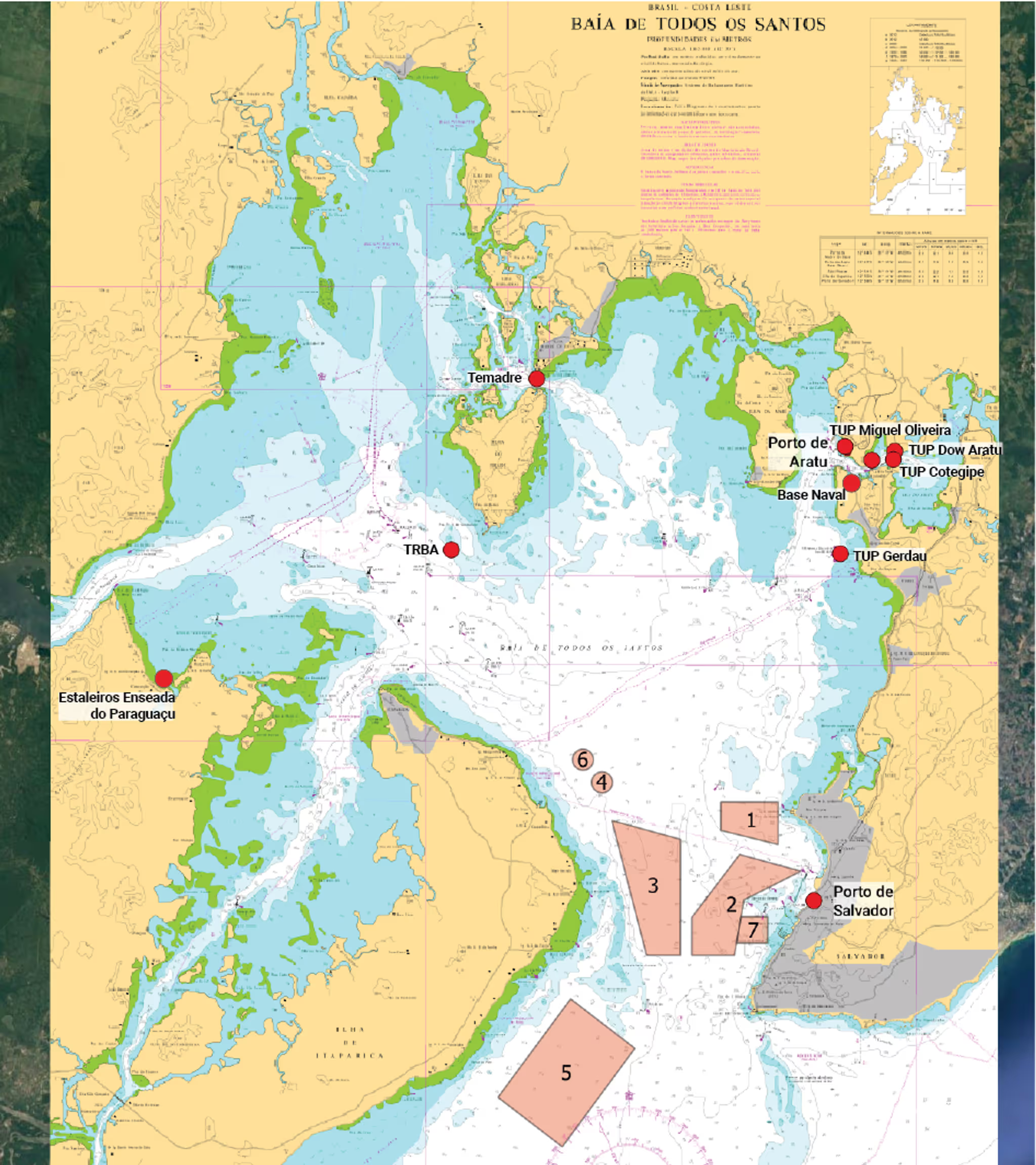
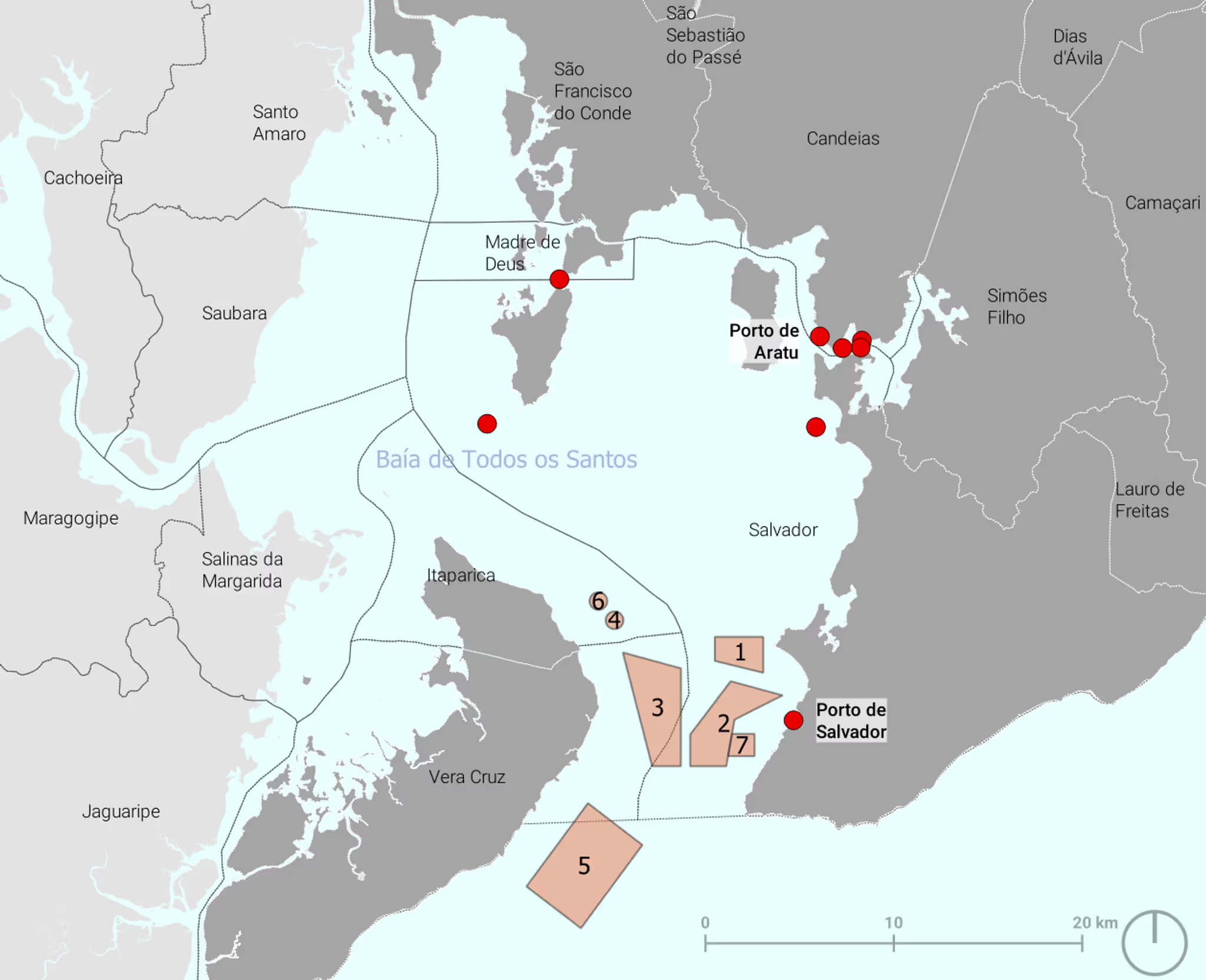
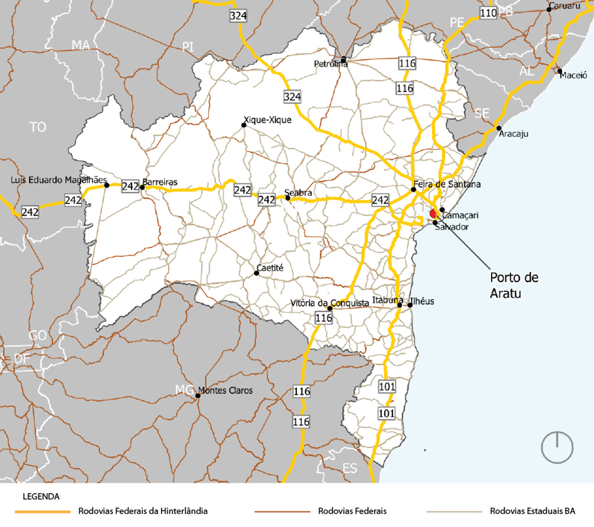
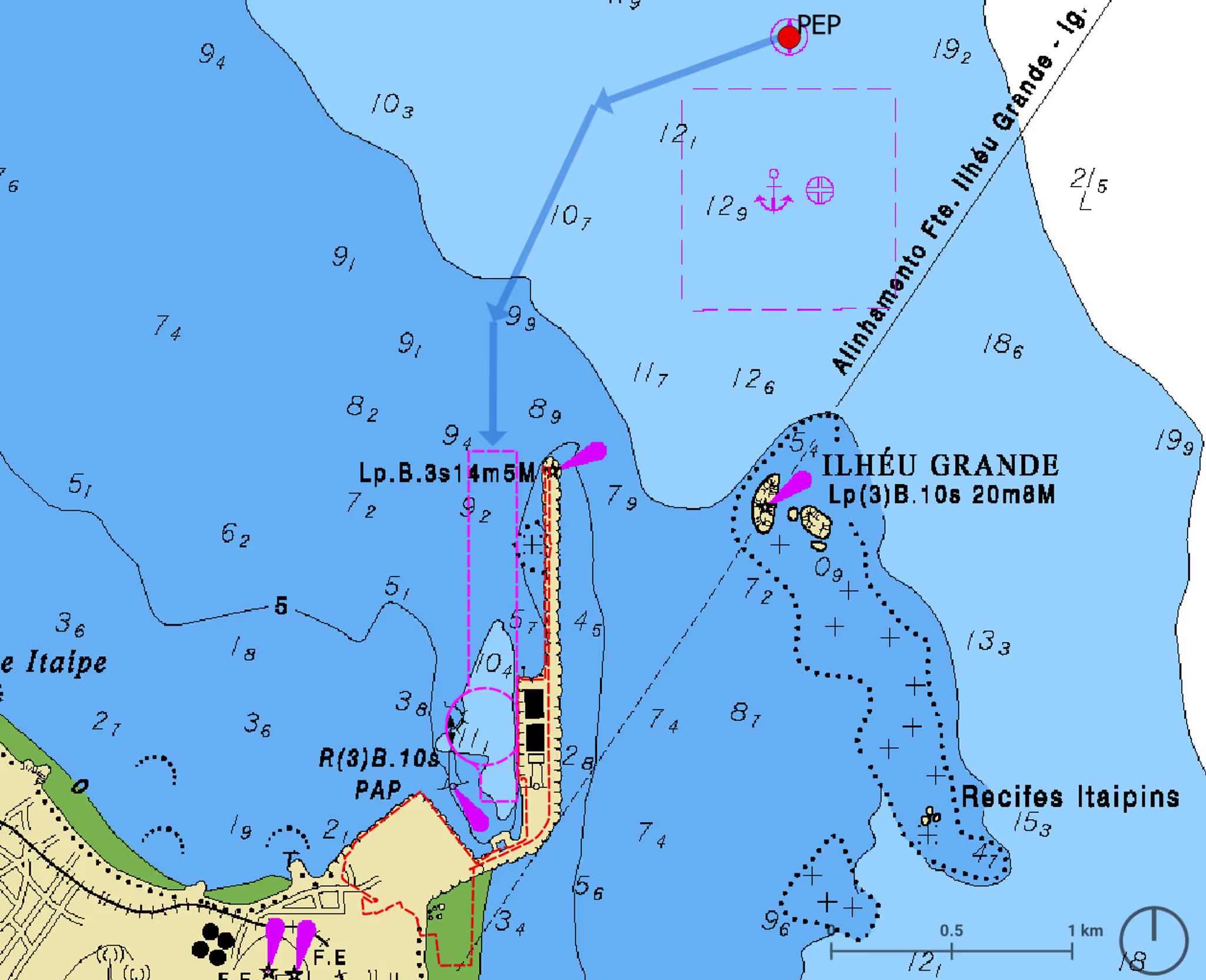
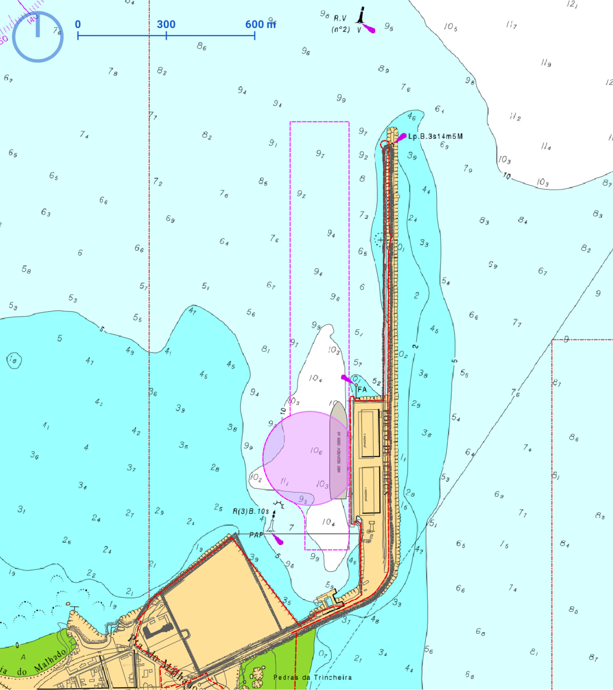
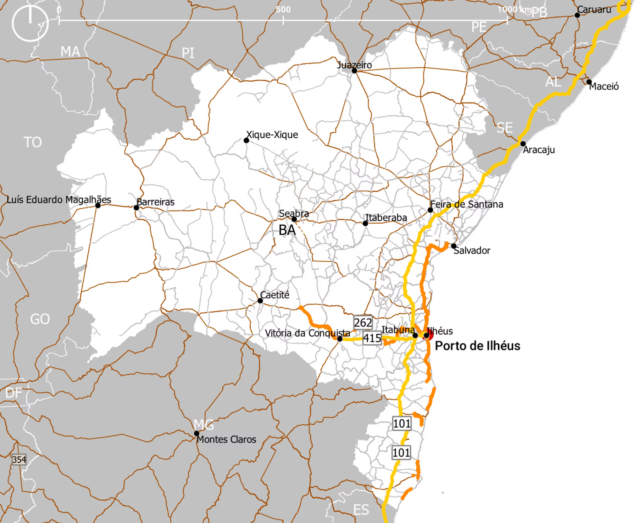
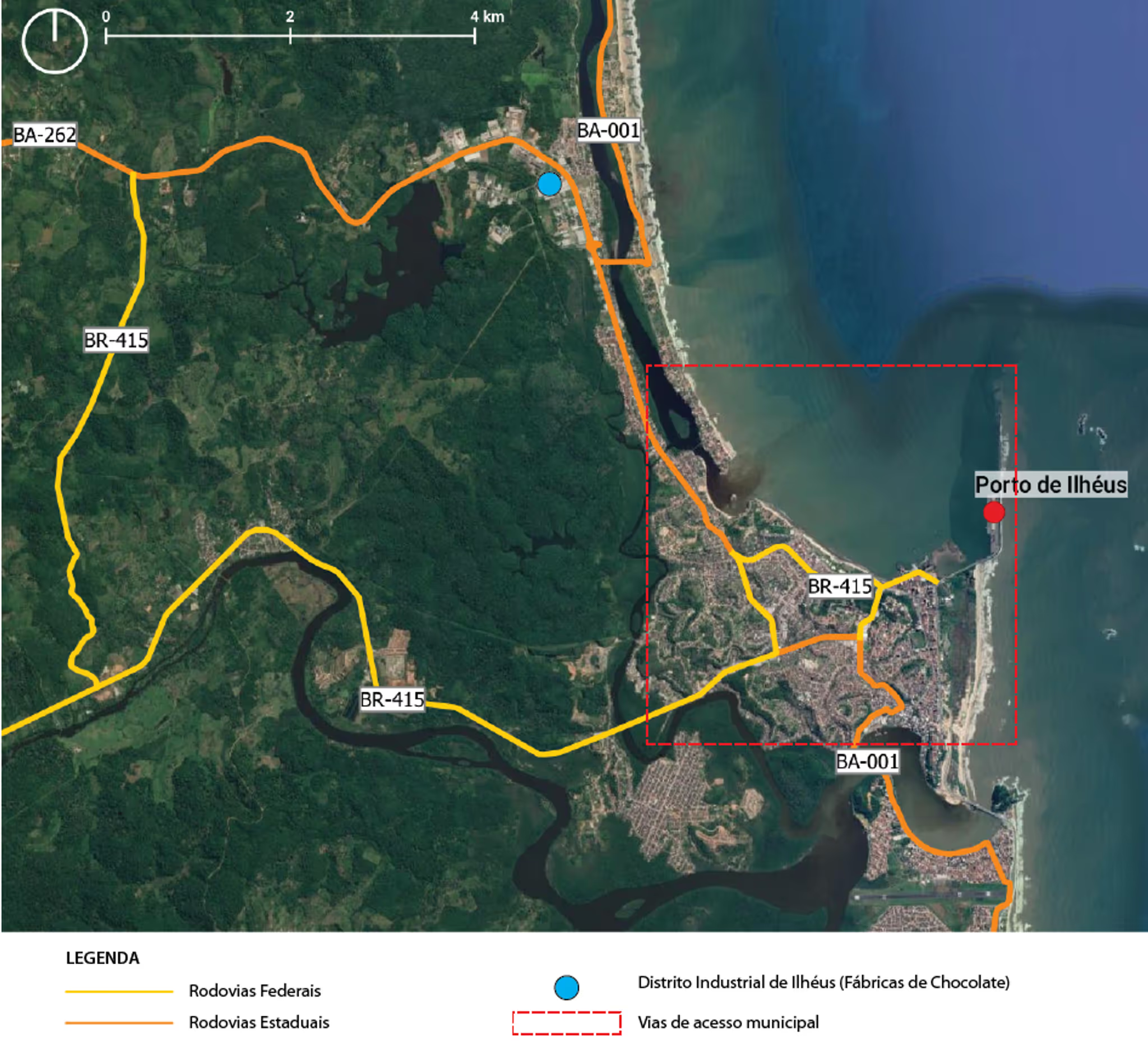
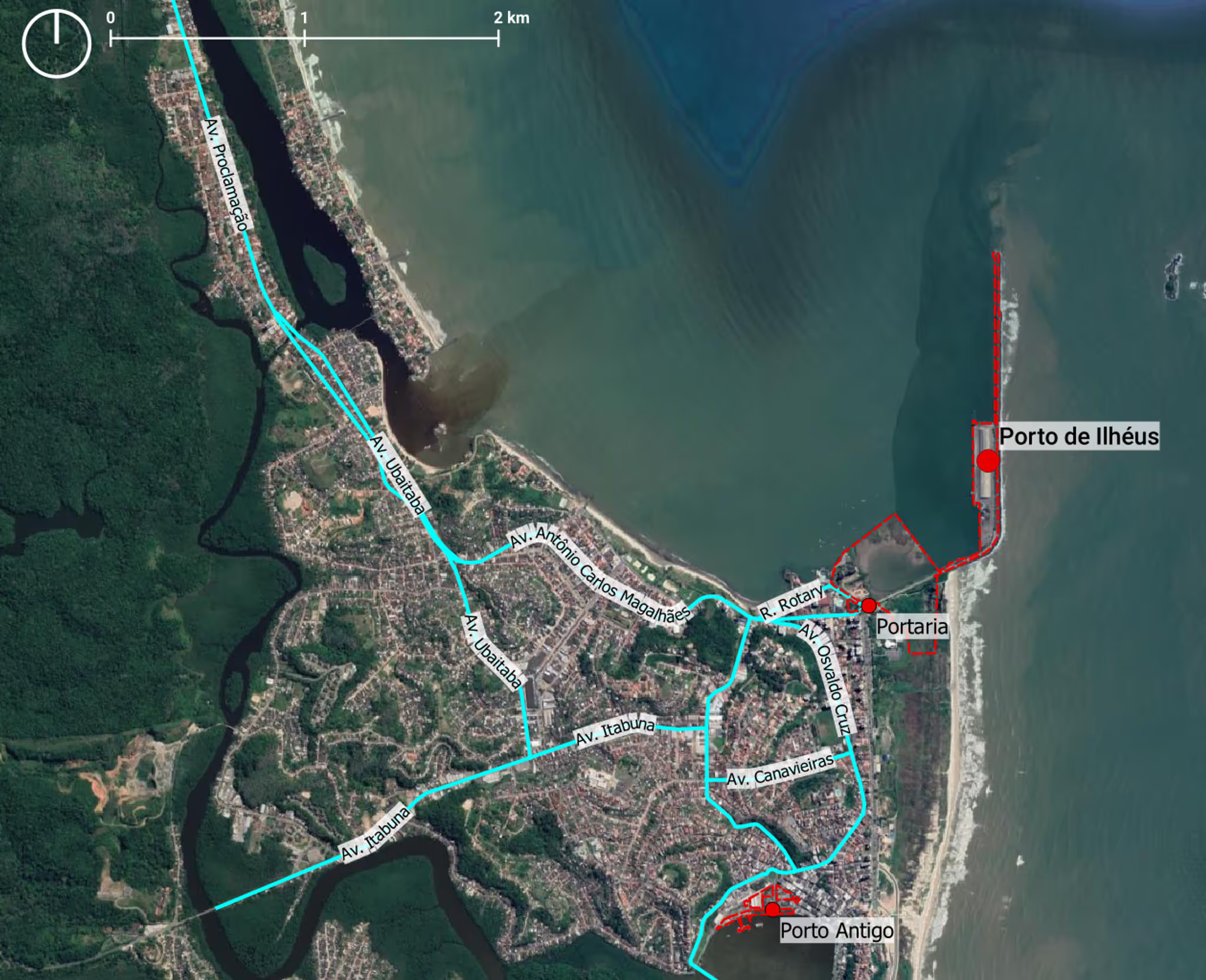
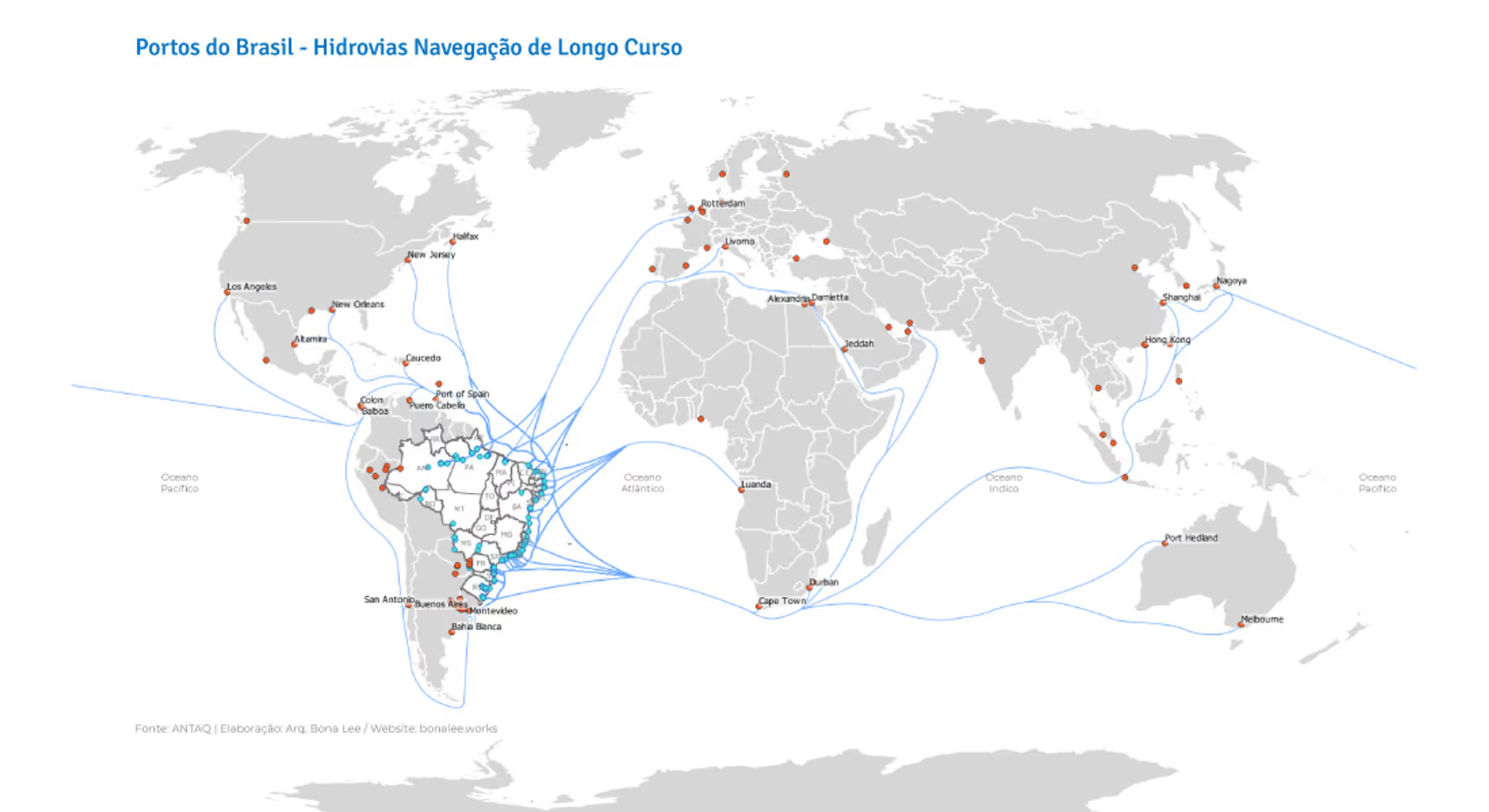
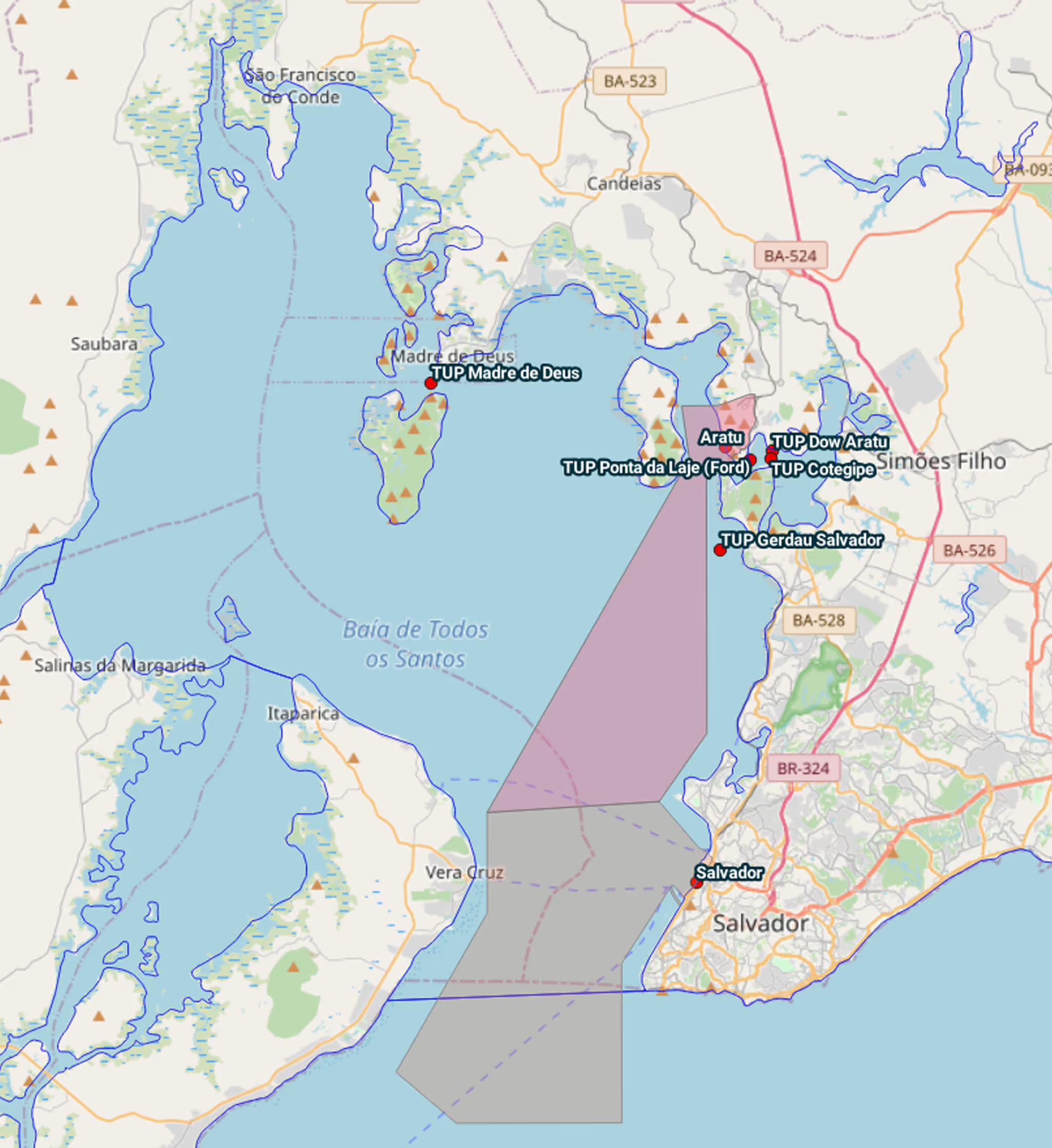
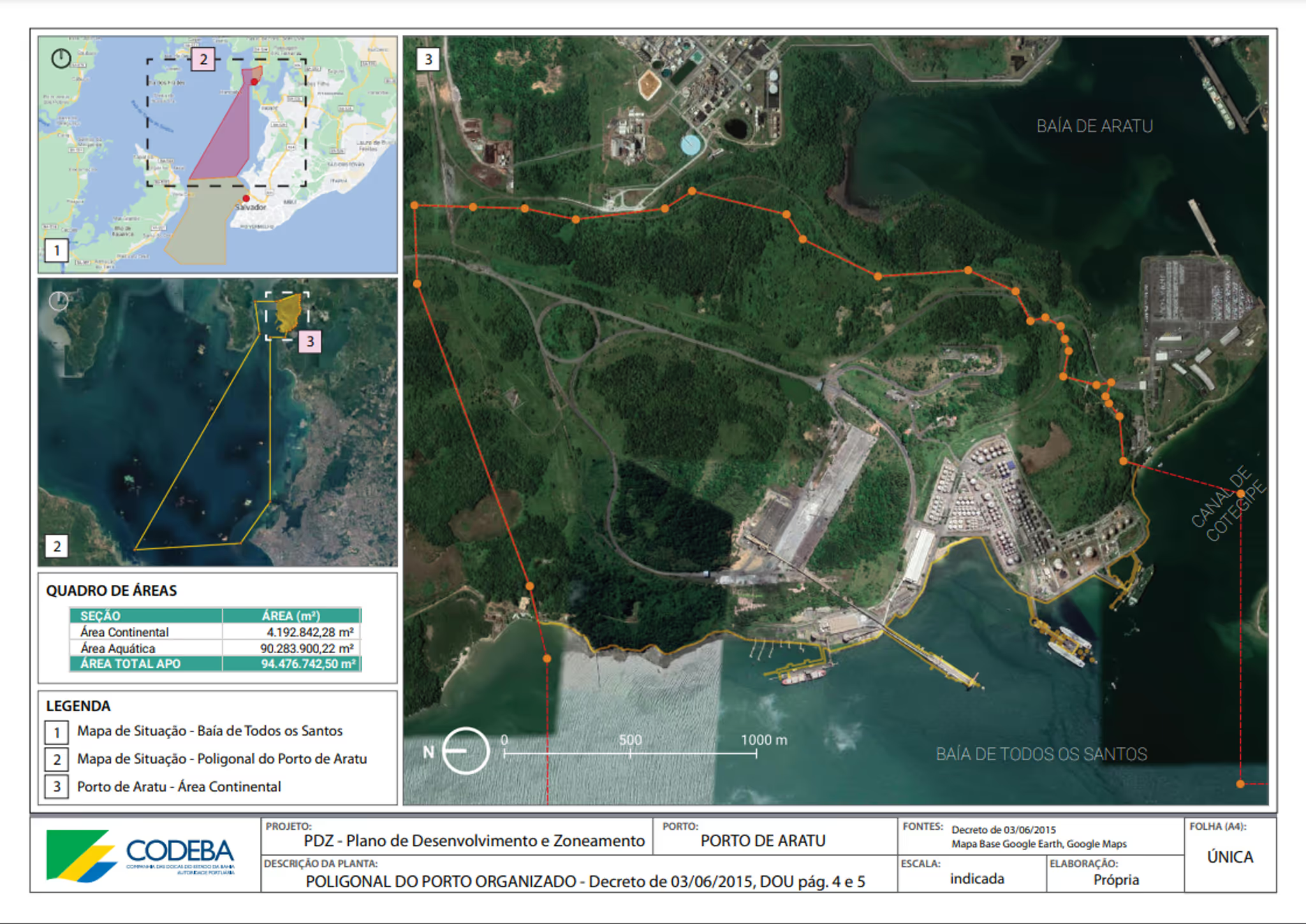
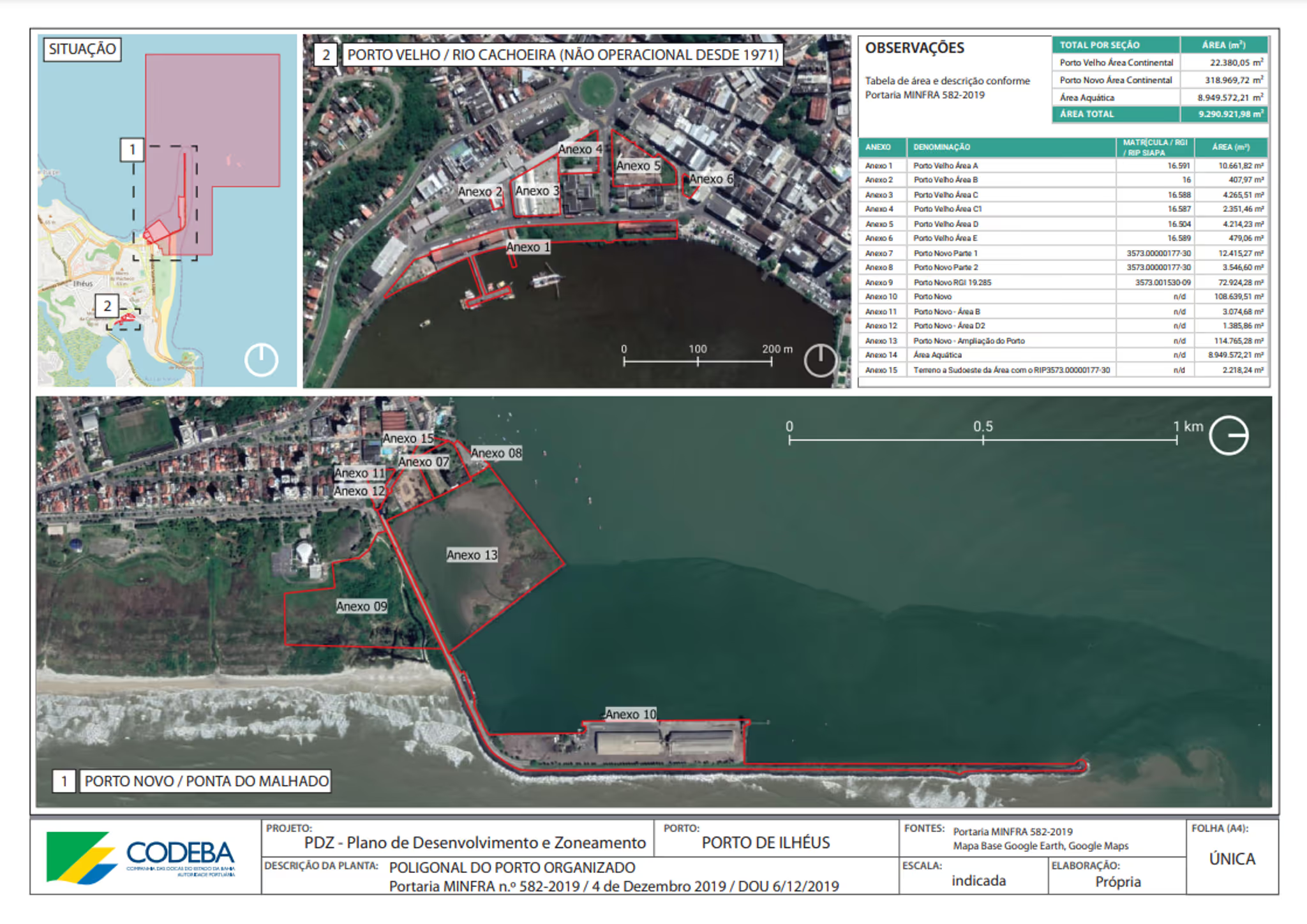
I create, edit, visualize, analyze, and publish geospatial information using QGIS. This includes the creation of customized and themed maps, plotting data on maps, and spatially visualizing statistics. I also provide strategic insights based on market data. My work enables better understanding and decision-making by revealing patterns, relationships, and trends in data through geographic visualization. ***
}
*** My specialization is in urban and transportation data, along with spatial statistical analysis, so please note my work does not extend to environmental satellite data analysis.